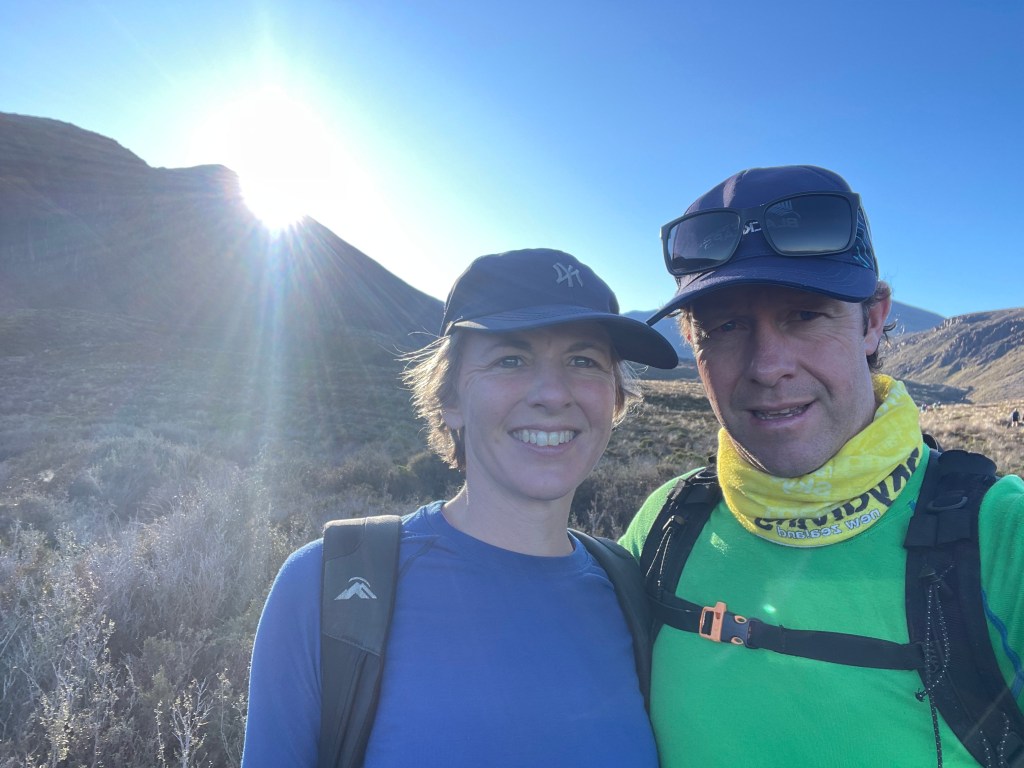
Last weekend, Rachel and I marked our 21st wedding anniversary by walking the Tongariro Alpine Crossing. It was an unforgettable one day walk filled with stunning landscapes.
Perfect Weather for the Perfect Day
The weather couldn’t have been better. The sky was clear, giving us uninterrupted views of the incredible volcanic terrain. At the highest points, a steady breeze kept the temperature at a brisk 9 degrees, but out of the wind, it was a warm 25 degrees.
The Journey Begins
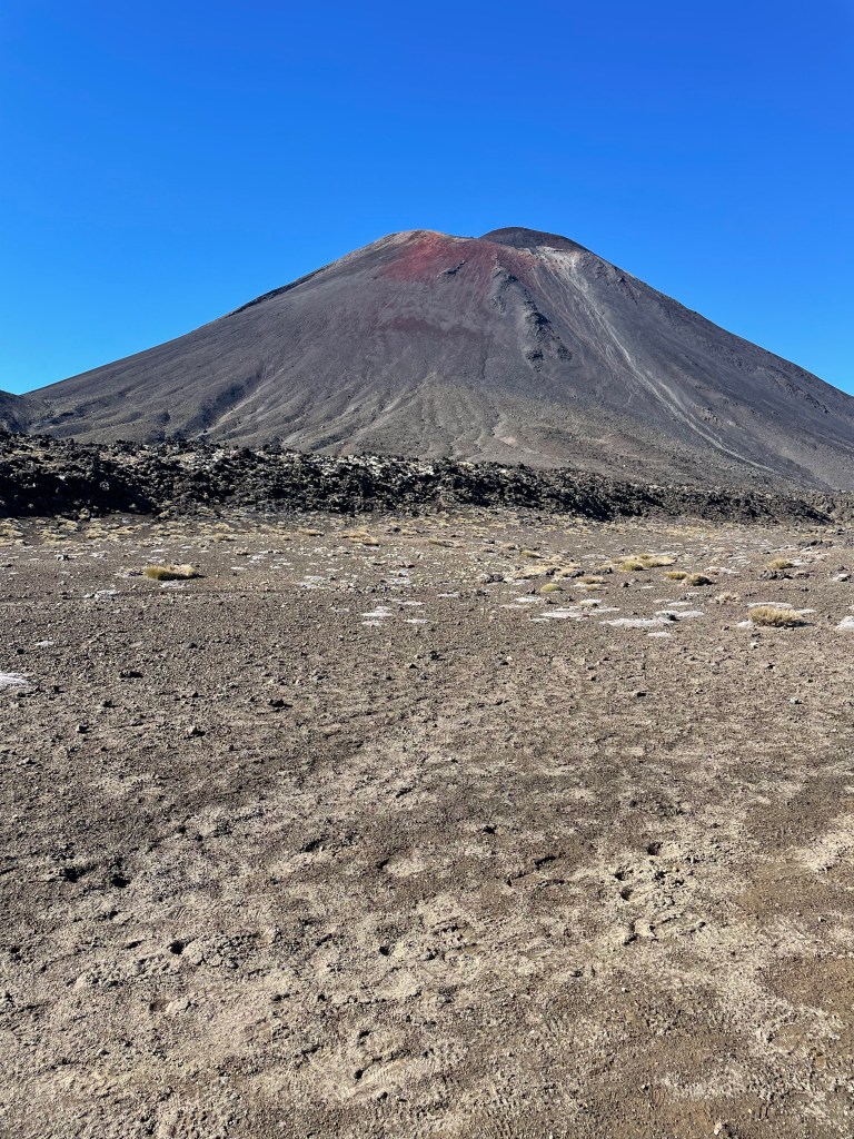
The 20 kilometre trail starts at Mangatepōpō Road end and winds through the Tongariro National Park, a UNESCO Dual World Heritage Site. The track climbs from 1120 meters above sea level, ascending the Mangatepōpō Valley to the saddle between Mount Tongariro and Mount Ngauruhoe.
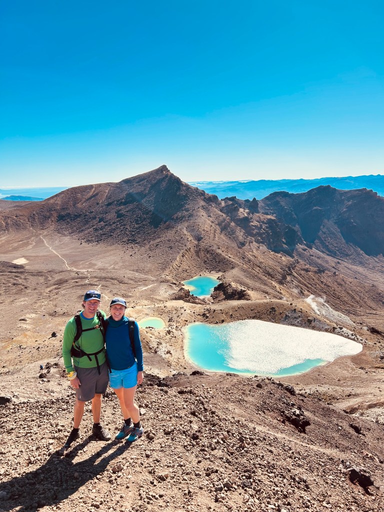
From there, the journey takes you through the South Crater and up to the dramatic Red Crater, the highest point of the crossing at 1886 meters.
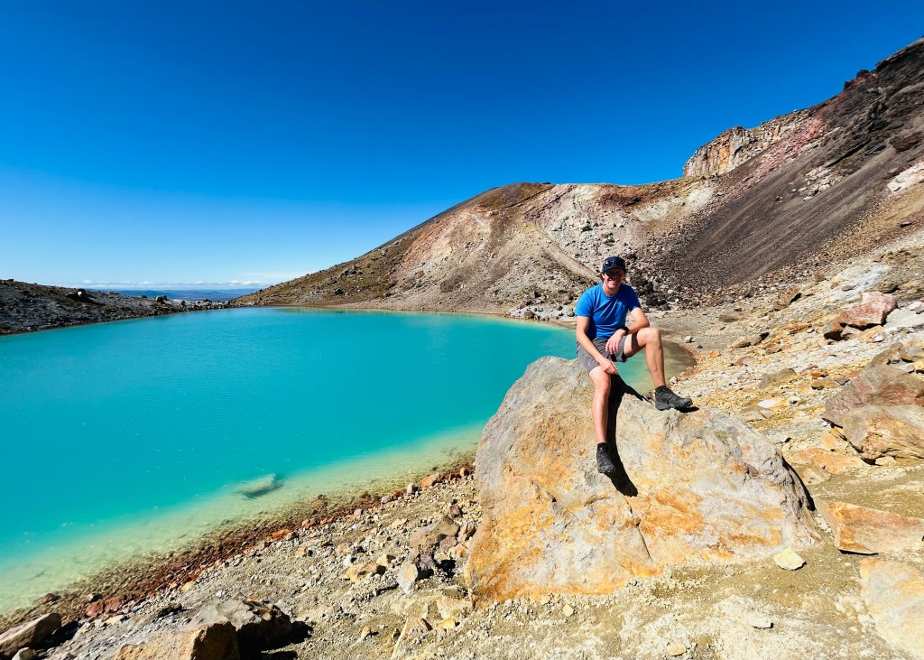
Standing at Red Crater, we were rewarded with panoramic views that felt otherworldly. The vivid hues of the Emerald Lakes (Ngarotopounamu) were below us and their greenstone-like colours contrasted beautifully with the volcanic rock.
A Descent Through Beauty
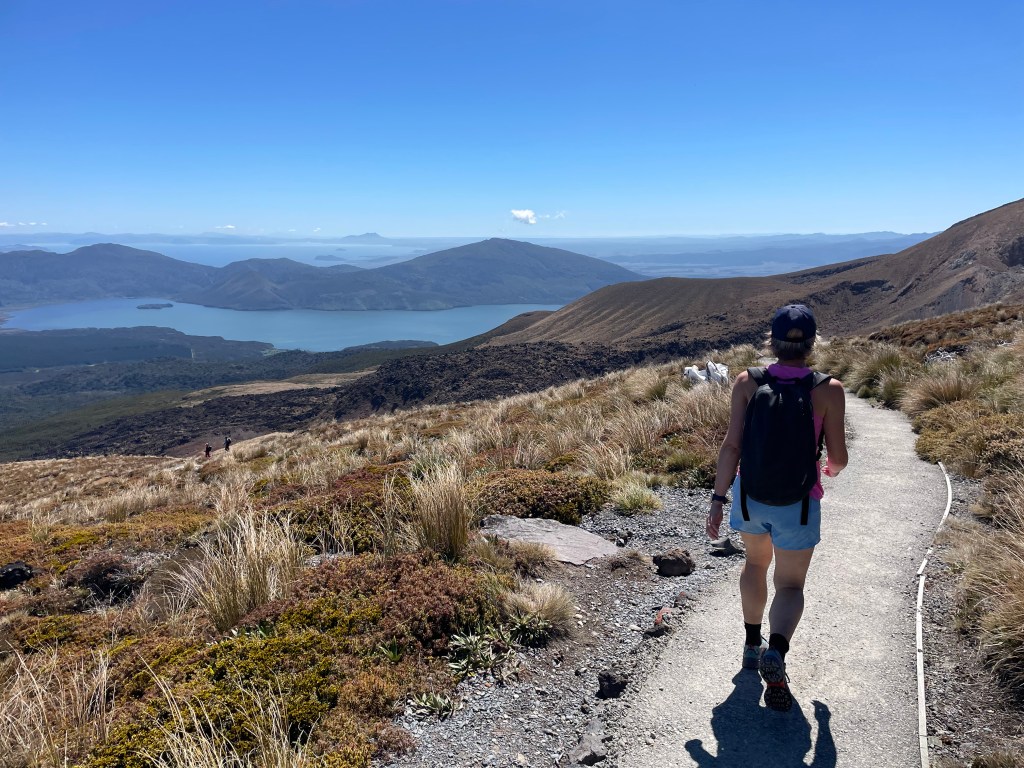
The descent from the Red Crater to the Emerald Lakes is a volcanic scree track, challenging but worth every step. As we continued, we passed the serene Blue Lake (Te Wai-whakaata-o-te-Rangihiroa), known as Rangihiroa’s mirror. The trail then circled the northern slope of Tongariro before zigzagging down past Ketetahi Shelter and ending at Ketetahi Road end, at an elevation of 760 meters.
Throughout the journey, we were impressed by the track’s condition. A lot of maintenance work was evident, especially on the descent. We even had a couple of helicopters flying in dropping off water and gravel for those working on the track. It was great to see such care being taken to preserve and improve this part of the trail.
Tips for Future Adventurer and those wanting to do the crossing.
- Be prepared for all weather conditions: Alpine environments are unpredictable. While we enjoyed perfect weather, it’s vital to check forecasts and pack warm, waterproof clothing.
- Plan your transport: We recommend booking a shuttle. It basically costs $60 per person but the parking was easy and the shuttle quick and efficient. Parking restrictions now mean that there is a 4 hour limit along the road.
- Take plenty of food and water: This is a full-day hike, so be ready for 6 hours of walking. We tend to walk fast so it was around 4 hours of walking and 1 hour of stops for food and photos.
- Use the facilities: The park provides toilets at regular intervals along the trail.
- Respect the environment: Remember that the mountains and lakes hold deep cultural and spiritual significance. Stay on the paths, use provided facilities, and avoid touching sacred waterways.
- Check out the video and maps below.


Reflecting on 21 Years
As Rachel and I walked side by side through this incredible landscape, we reflected on the journey of our marriage.

Leave a comment