Nestled in the verdant landscapes of New Zealand’s North Island, the Lake Waikaremoana Track is one of three Great Walks that showcase the breathtaking natural scenery of the region. These premier tracks are maintained to a higher standard than typical backcountry routes, offering superior accommodation options along the way.
Less frequented than its southern counterparts, Lake Waikaremoana provides a more secluded experience. Here, the landscape trades alpine vistas and coastal paradises for dense, stunning native forests and serene atmospheres, making it an ideal destination for those seeking a connection with nature and time off grid. There is no internet signal on this track..
Lake History
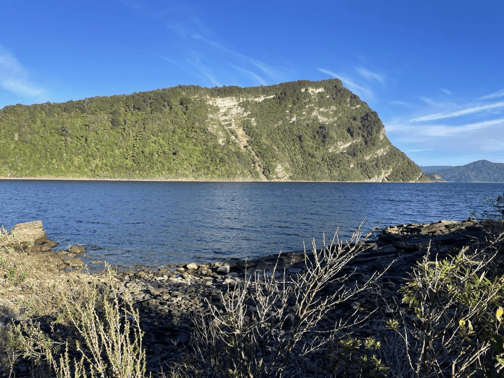
Lake Waikaremoana, located in the northeast of the North Island within the secluded Te Urewera Forest. It is the country’s deepest lake and among its largest. The area features the island’s most extensive native rainforest, isolated river valleys, cascading waterfalls, and a variety of native birds.
Te Urewera, interestingly translates to “burnt penis,” derives its name from a legendary incident involving a Māori chief. Centuries ago, the chief tragically perished after rolling too close to a campfire during a hunting expedition, an unfortunate event that led to the area’s distinct name. Thankfully no open fires are allowed now and with everyone using gas to cook their food a repeat of such a painful incident is very unlikely.
Once a national park, Te Urewera underwent a transformation in 2014 when it was recognized as a legal entity, the first of its kind globally, with the same rights as a person.
The Tūhoe, also known as the Children of the Mist—a name inspired by the frequent, misty veils that shroud their homeland—are a Māori iwi with deep roots in this region. They have maintained a strong cultural identity and tirelessly campaigned to regain control over their ancestral lands. The governance of Lake Waikaremoana by the Tūhoe marks the first time a Great Walk is managed outside of the Department of Conservation (DOC).
The Track
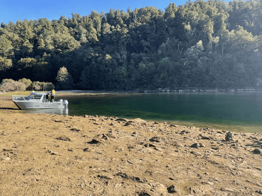
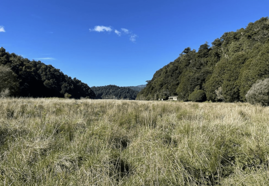
The Lake Waikaremoana Track forms a semi-circular route around the lake, starting at Onepoto Bay Shelter and ending at Hopuruahine Landing (many people miss the last 3km as the water taxi now picks up up or drops you off at Whanganui Hut).

Spanning 46 kilometers, the entire walk features five huts and campsites along the way. Known for its accessibility, the track offers a fulfilling challenge for adventurers of all levels.
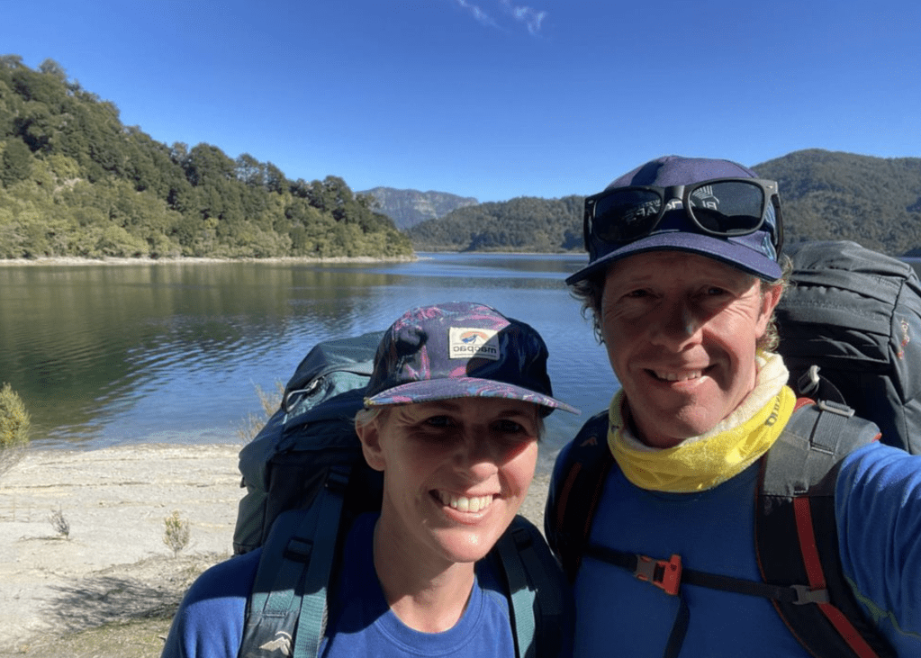
While the majority of hikers complete this walk in four days, the track offers flexibility to suit varying levels of fitness and preference. Rachel and I covered the distance in three days and two nights and started with the water taxi to Whanganui Hut at the far end.
Accommodations Before the Walk
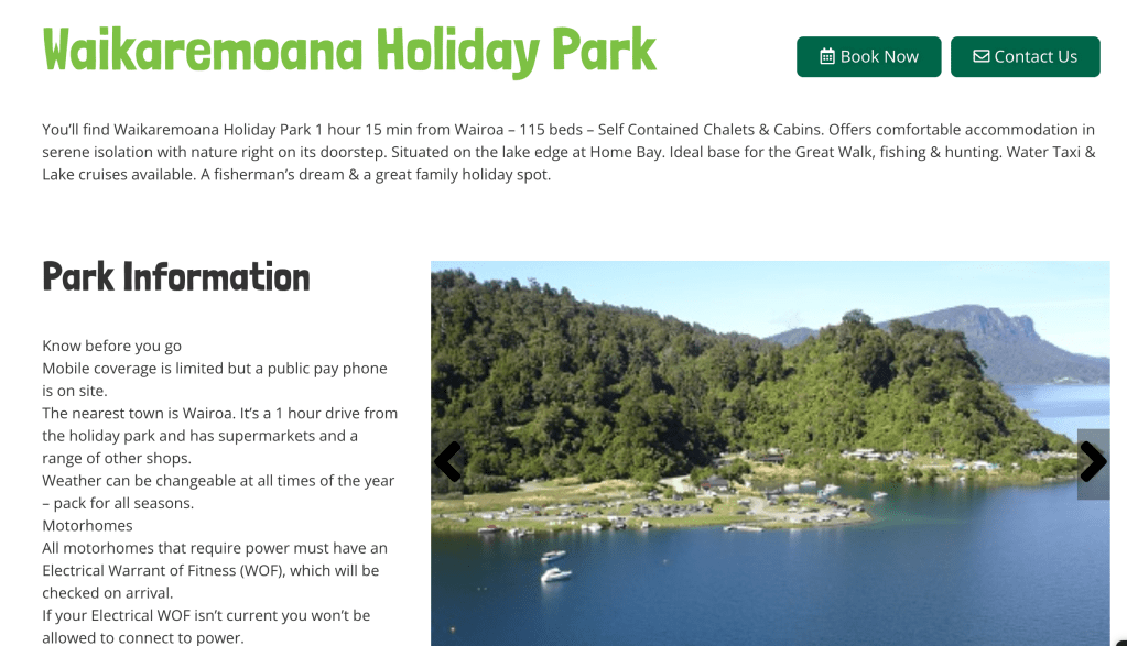
Before you set off on your Lake Waikaremoana trek, finding comfortable accommodation nearby is essential, though it can sometimes be challenging. The Waikaremoana Holiday Park is often the top choice for many hikers due to its affordability, good maintenance, and proximity to the trail’s starting point. Unfortunately, our experience at the park was less than ideal. We arrived at 5pm on a Wednesday night to find everything closed and, without a phone signal, were unable to contact the staff for assistance. After driving 30 minutes in an attempt to find a connection and still receiving no answer, we returned, resigned to spending a night in the car. As night fell, and just as we were settling into our sleeping bags, a helpful local organising an upcoming fishing competition suggested we check the doors of the accommodation. Fortunately, we found one unlocked and, having already paid, decided it was best to use it for the night.
Day One: Hopuruahine Landing to Marauiti Hut – 13.4km
Garmin Data
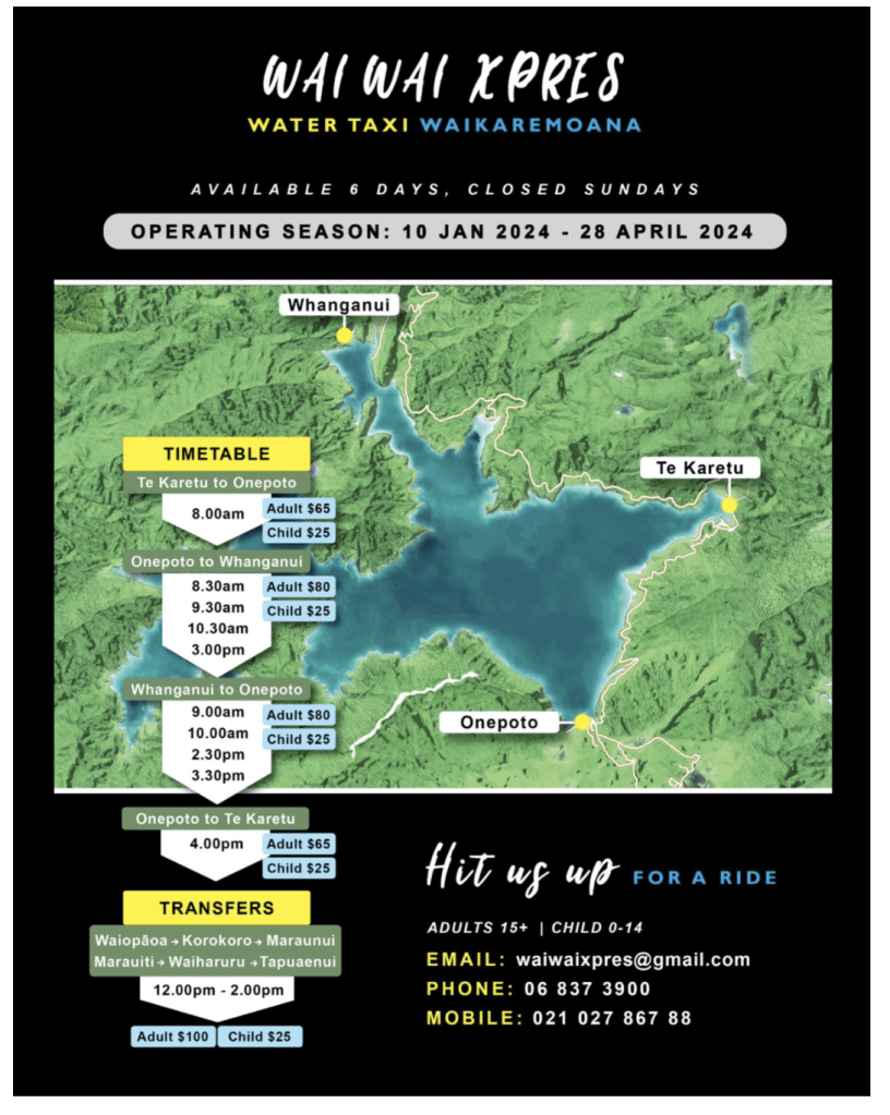
Our adventure kicked off with a water taxi from Onepoto to Hopuruahine Landing. Find the water taxi was difficult but if you just wait by the boat ramp at Onepoto it will arrive.

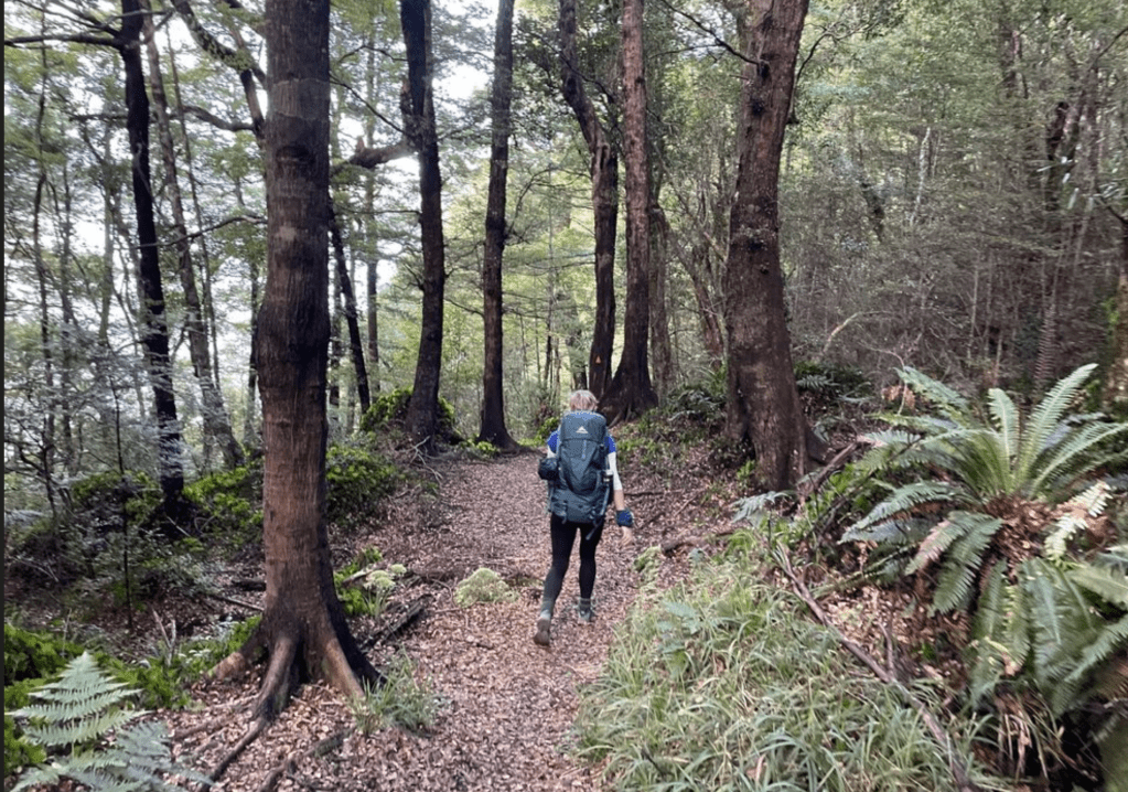
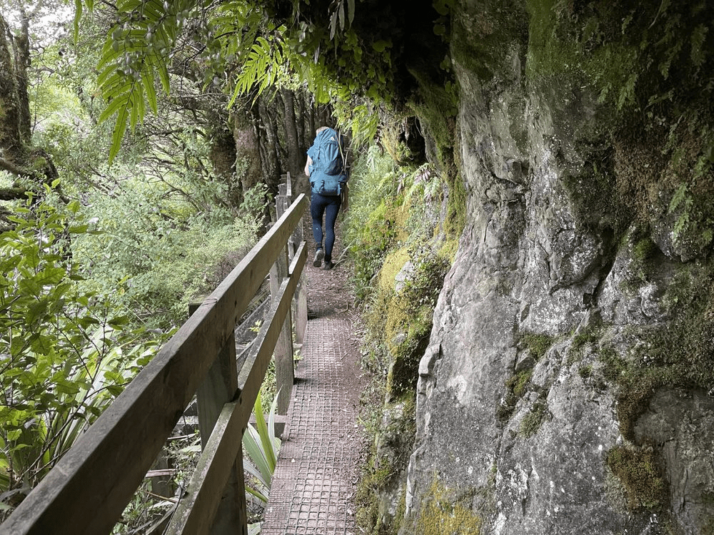
The first leg of the track introduced us to the lush, ancient landscape of Te Urewera. Upon reflection this was probably the worst kept part of the track. Compared with alot of great walks the tracks was not as well maintained, with large muddy bog sections common.
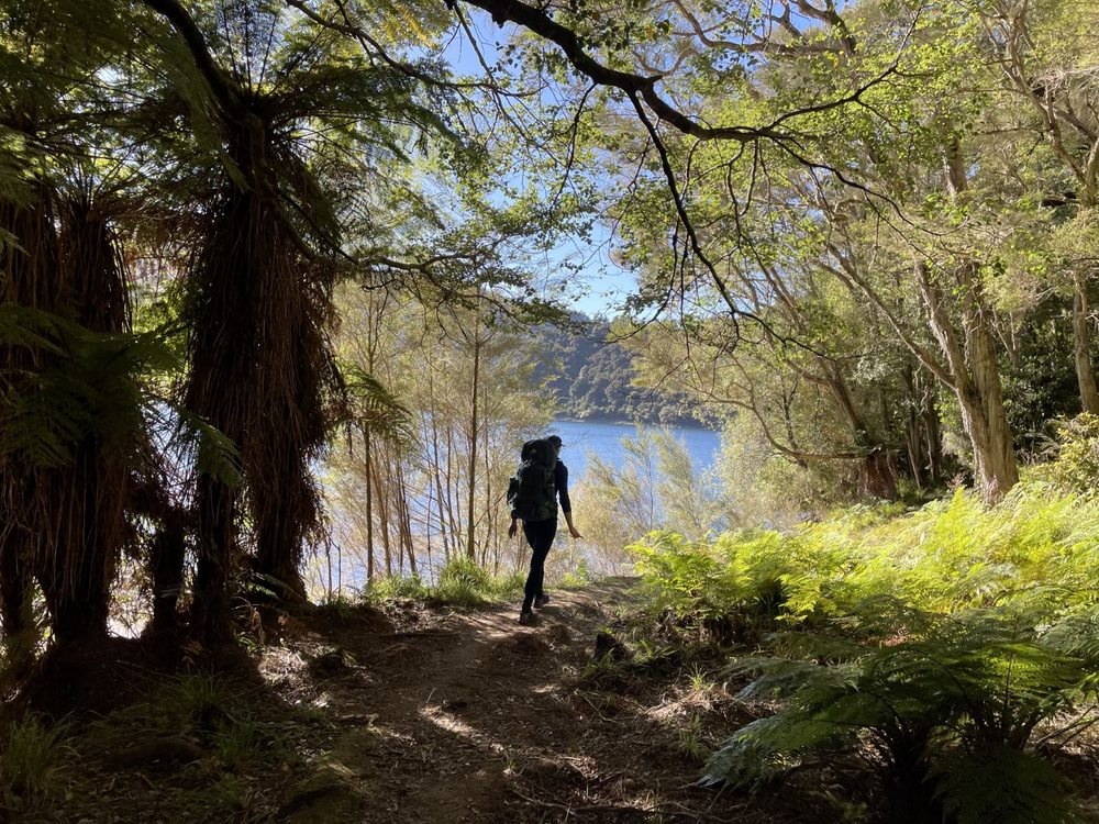

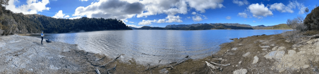
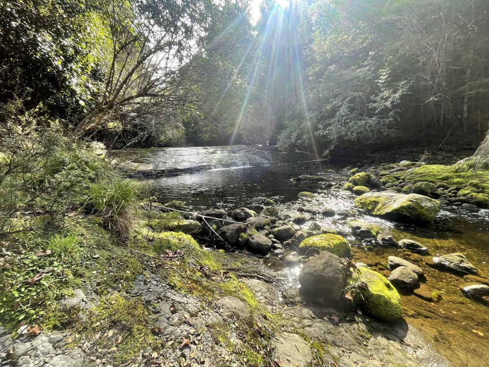
Although challenging with its undulating terrain and muddy sections, the stunning lake views made the effort worthwhile. This section was relatively flat. It took us 90 minutes (7km) to get to Waiharuru Hut where we stopped for lunch. This is a large Hut which is popular with those going in the opposite direction as it means a small final day to get the water taxi.

From here we pushed on to Marauiti Hut which was another 6km. We stopped a number of times to look at the lake or amazing forest and made it to the hut in a total time of 3hours 45min. However 2hr 42min of that was moving time which gives you an idea of how fast Rachel walks and the relative flat nature of this part of the track.

Day Two: Marauiti Hut to Waiopaoa Hut – 16.7km
Garmin Data
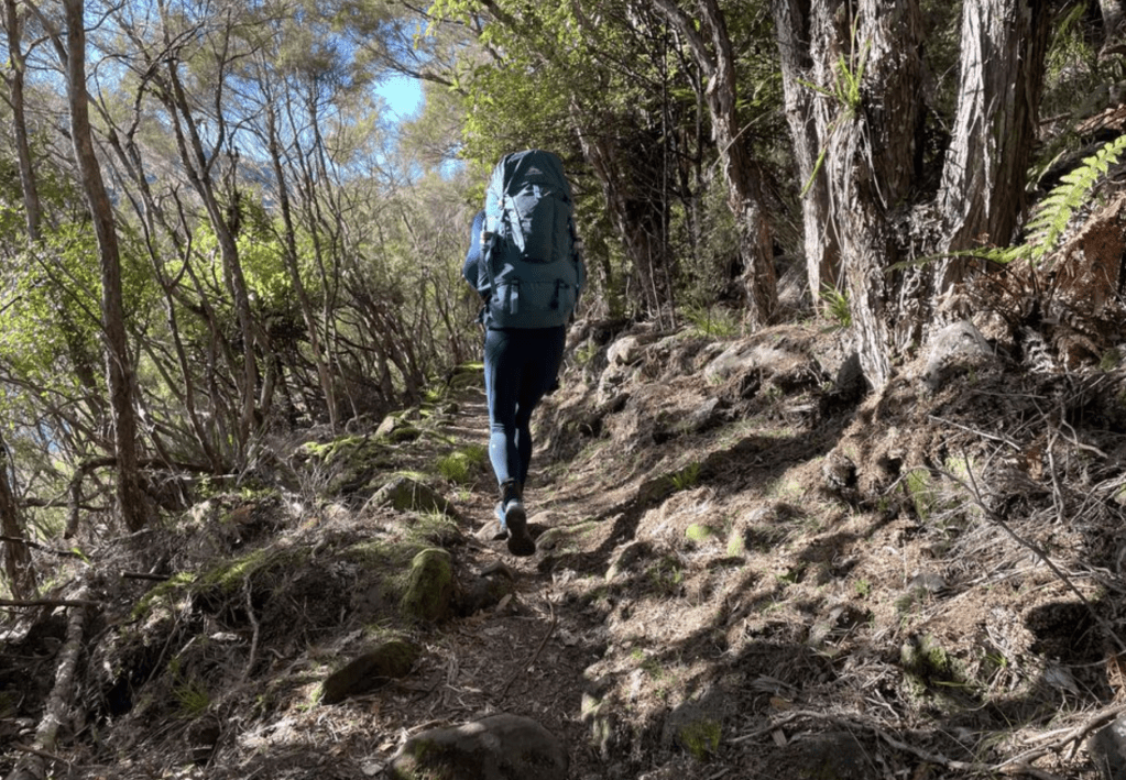
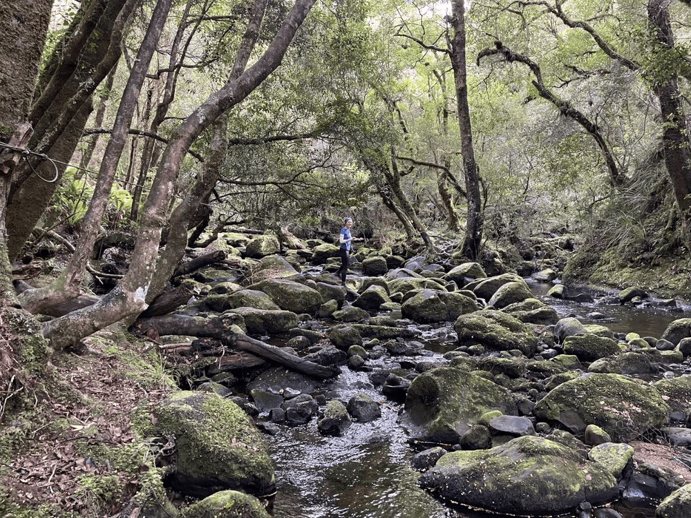
Departing Marauiti Hut, the landscape transitioned to a beach forest, less vibrant but easier to navigate. This part of the track was very easy and less muddy than the day before. As usual we pushed on a steady pace with the track being a littlemore up and down compared with our first day.
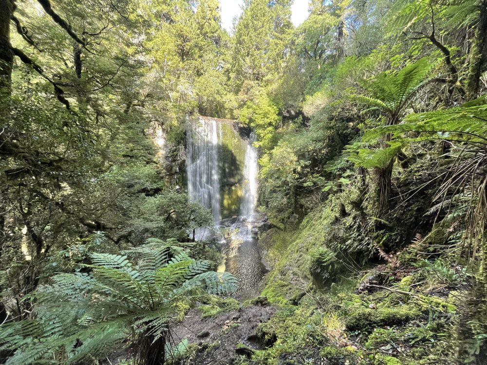
The highlight of today was the detour to Korokoro Falls, a spectacular and serene escape from the main path. This added around 3.5km to our journey length, but it was worth the time. The falls, although not brimming with water were still spectacular.

The day ended at Waiopaoa Hut which is another large and comfortable hut. Infact I would say the nicest of the trip due to its outlook over the lake. Disappointingly, the cold breeze and low water levels kept us from swimming today.

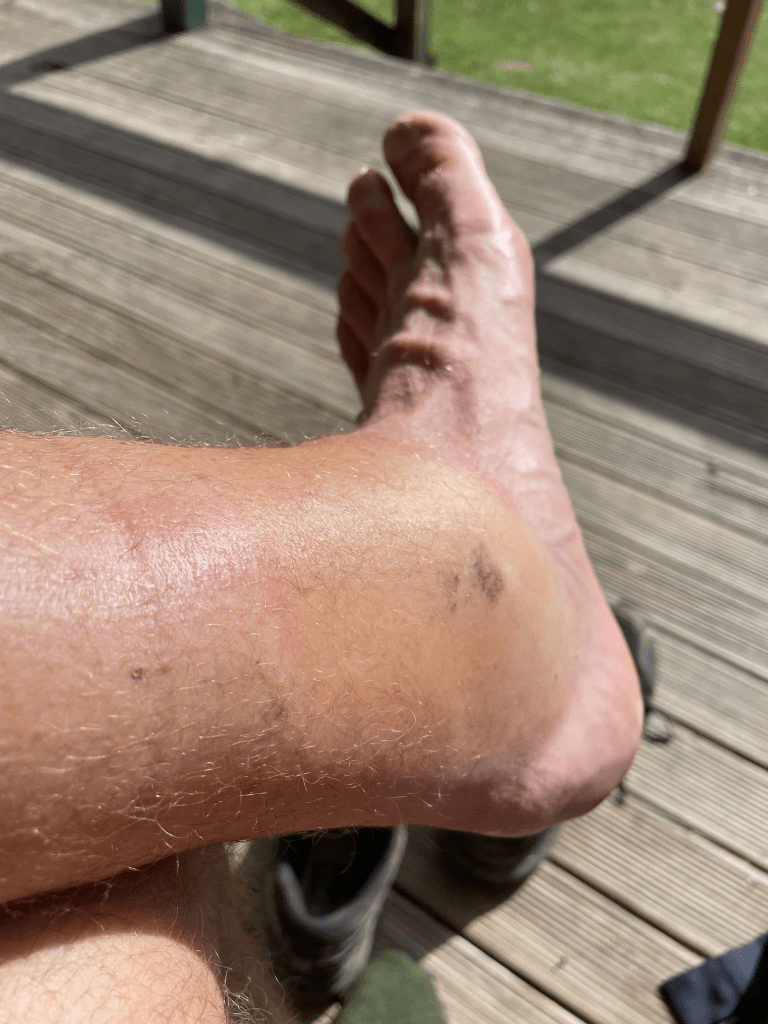
On a personal level my left ankle had decided to play up at this stage. I was stung by a wasp on day one and the heat and exercise had caused severe swelling. On top of that, around the bite, severe blisters had formed. We didnt have any form of antibiotics and so it was at this hut Rachel and I decided that we wouldn’t be staying the night at the next hut which was Panekire Hut and would complete the next two days in one long day.


Day Three: Waiopaoa Hut to Onepoto – 19.4km
Garmin Data P1 and Garmin Data P2
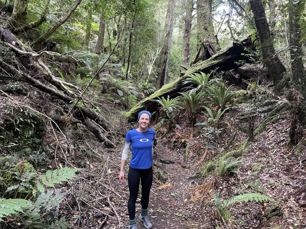
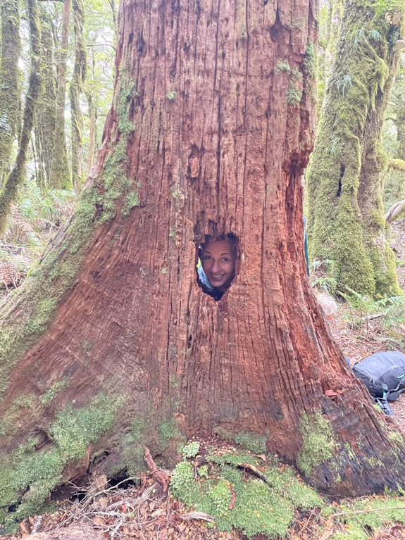
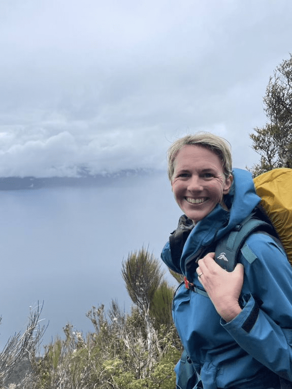
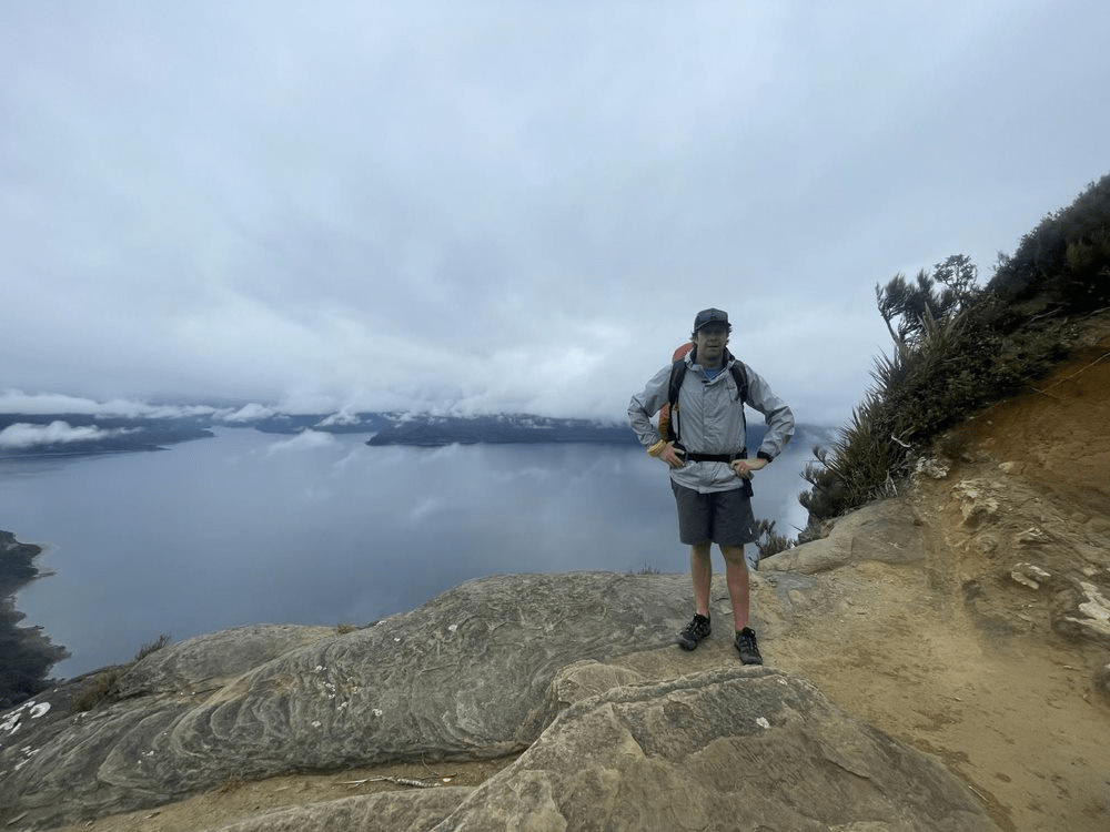
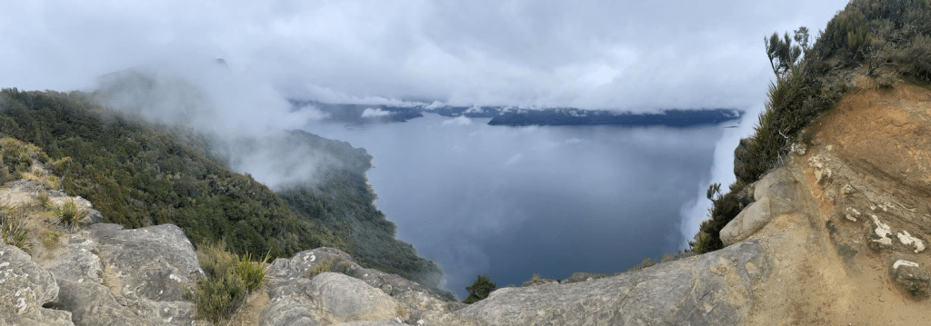
Anticipating a challenging day, we faced steep climbs and rugged terrain. The first part of the day was probably the hardest. The uphill section was steady and gradual to begin with but around 5km there were some extremely steep stairs until we made it to the plateau. Without doubt the best scenery on the trip can be found along the 9km or so along the Panekire Bluff. Firstly, there is the stunning native Forest which is magical. The ages of the thick, moss covered trees must be in the hundreds of years. For us with the mist around us this made for some breathtaking and mystical views.


We made it to up to Panekire Hut with the speed of mountain goats (dead on 2 hours) and stop for a look at the sensational view, some food and a hot chocolate. Pushing on for home we followed the ridge line for around 6 km. While the map said that this was relatively flat we found this very undulating and ended up increasing our elev ation by 200m. However, this was easily forgotten due to the sensational views on this part of the track. with large stone outcrops, overlooking Lake Waikaremoana, the views were incredible.


The final stretch was a steep but steady descent to Onepoto Bay and our waiting car. All in all today was a long day – just a tick over 19km in 4hr and 35min walking time. Although all up this took us 5hrs 45min when you took in our stops.
Once we arrived back it was raining so our decision to leave our car here was a good one. It enabled us to get moving straight away and negotiate the 90km of gravel road to get us home to Tauranga (4hrs).
Another Great Walk done and dusted.

Helpful Links
Lake Waikaremoana Holiday Park –https://holidayparks.co.nz/park/waikaremoana-holiday-park/
Water Taxi – https://www.ngaituhoe.iwi.nz/alerts-and-important-information
Lake Waikaremoana Bookings – https://bookings.doc.govt.nz/Saturn/Facilities/SearchViewGW.aspx
Detailed Blogs which we used as guides
What’s Dave Doing – https://whatsdavedoing.com/lake-waikaremoana-great-walk-guide/
Never Ending footsteps – https://www.neverendingfootsteps.com/lake-waikaremoana-great-walk-guide/

Leave a comment